
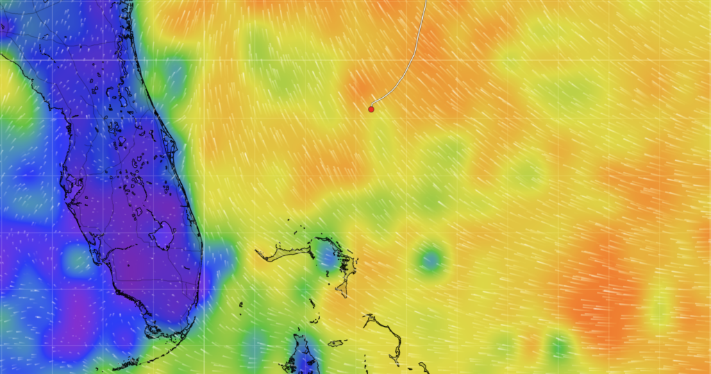
@ 13:54 GMT
Position: 29º 09.222 N x 76º 41.885 W
Course: 189° True
Speed: 6.4 kts, motoring
It’s 9:30 pm and it’s the third evening of the sail to the Bahamas. I am on watch until midnight. We are using a 3 hours on and 6 hours off watch schedule since there are 3 seasoned sailors on board, Francis, Mike and myself. This schedule works nicely. About 8am or 9am we are all up and someone makes the coffee, we make our individual breakfasts: sometimes a hard boiled egg with a Clementine or other times oatmeal. During the day we nap as needed, but continue the 3 on, 6 off schedule. The day consists of stories, reading, Scrabble or other games on the iPad. We schedule dinner for 5pm so that we can be together before the 6pm watch starts. At night we sleep as much as possible and have only one person up, the person on watch. This evening’s watch is ideal for me: 9pm-midnight. This will give me until 6am to sleep before my next watch, during which I will have a couple of cups of coffee.
Dinners have consisted of chili which was made the first night when we knew it would be cold. This evening is a bouncy ride since we are going upwind into 20-25kts of breeze, so we had the leftover chili to save cooking. Last night we had chicken curry and tomorrow should be an Italian dish – yet to be named – consisting of chopped up sausage in pasta sauce with pasta. Any naming suggestions please let us know.
It’s incredible how quickly the days go.
It’s a particular relief to not have high speed connections to the world. No news, no social media, but we do have satellite communications (low bandwidth) for small data packages, texting and talking to family.
Watch is pretty awesome – we have a remote control for the autopilot and the chart plotter is connected by local WiFi to an iPad. Everything can be done while protected from the elements. Every few sentences I write are interrupted by looking at the chart plotter, the radar and a 360° lookout for other vessels.
Since entering the Gulf Stream on the first day we have seen just two vessels. This is not due to lack of looking – we have radar and AIS (automatic identification system) to alert us to traffic. There just isn’t much out here and the ocean is a very big space.
We just had a vessel pass us that was on a course for southern Florida, Miami perhaps or even to the Gulf of Mexico. When these vessel pass I wonder who is on board, what are their stores, where are they from? I wonder if they do the same about us?
Tonight the wind is predicted to lighten and turn to the south. This will lead it to be right on the nose as we try to head to the Bahamas. We have been carefully following the weather forecast and knew this would occur. So after we exited the Gulf Stream although sailing south we went east of the rhumb line (the standard method of plotting a ship’s course on a chart) so that the turn in wind direction would turn us back toward our destination. Since I have been on watch for 40 minutes now the wind has turned 15 degrees to the south. As we turn with the wind we will sail to the longitude of our destination, then will drop sails and motor into the wind for the remainder of the delivery. I sure hope the wind declines as it turns!
I have waited to send in this blog for this moment – at 2309 (11:09pm), we have 199 nautical miles to go, with 458 nautical miles elapsed.
Morning update:
Squalls overnight with gusts up to 30 knots meant that Phil and Mike stood watch together until 3am. Around 7:40am this morning the wind turned directly from the south, which would have only allowed the boat to sail too far to the west. They’ve dropped the sails and will now motor to the finish line!