

With the advent of Global Positioning System (GPS) it is simple to know with accuracy of inches to feet where we are around the globe. On land we use maps, street names, and various landmarks to help us know where we are. On the ocean, especially offshore, one patch of water looks like another, with nothing on the horizon to help you get your bearings. The navigators of earlier centuries did not have the benefit of electronics to triangulate their position, yet they managed to cross oceans and find their way back home.
Over the winter I took a celestial navigation course with the aim of turning off my GPS during a future sailing trip and then rely on these tried and tested celestial navigation methods. The class has been a wonderful experience, using my brain to tackle new problems and it prompted me to think about the early navigators. My instructor, Chris Nolan from Sea Education Association (SEA), has brought to life the navigational life of early seafarers. As they sailed from Europe south and caught the Tradewinds that would propel them to the west they were able to readily determine their latitude or position north/south from the equator by using a sextant (a glorified protractor) to calculate the angle between the object (e.g. the sun or a star) and the horizon.
By making noon sights when the sun is due south or an evening sight on Polaris (due north) they could navigate across to the Caribbean along a line of latitude. But a challenge was to determine how far they had sailed to the west. Longitude (east/west position) was needed to estimate when they would make landfall and thus prevent a shipwreck. For this to be achieved a timepiece or chronometer was needed that could keep accurate time.


Accurate navigation at sea was critical to the British, who were exploring the world by crossing the oceans. So important that the King established the Longitude prize in the 1700s that was to be awarded to the person that developed a time piece that could accurately tell time. Although the prize was never officially awarded (politics existed then too) John Harrison developed a series of chronometers and was awarded a total of £23,065.
The need for accurate time was the fact that the earth was constantly rotating in space. Since the earth rotates 360 degrees per day, it rotates 15 degrees per hour (360/24h). And while astronomers could determine the exact positions of the stars relative to each other they needed to fix a baseline or reference on earth. 0 degrees longitude is arbitrarily assigned to a line running through Greenwich, London between the north and south poles. The navigator needed to know how many minutes of time (every hour was 15 degrees of Longitude) he was from the baseline.
The US Naval academy taught celestial navigation to its cadets but stopped the instruction in 1998. However, in 2015 it reintroduced this course because of the concern that hackers might bring down the global GPS system.
Finding Our Way

One example of how to find our latitude (if in the northern hemisphere) is to use the sextant to measure the angle between the north star Polaris, and the horizon. If we were standing on the north pole, Polaris would be directly above our head and 90 degrees from the horizon. Not surprisingly, this latitude is 90°N. If we were halfway between the north pole and the equator the angle from Polaris to the horizon would be 45°, and we would be at a latitude of 45°N. If we were at the equator (0° latitude), the star would be at the horizon, or at an angle of 0°.
0° longitude is arbitrarily assigned to a line running through Greenwich, London between the north and south poles. Since the earth rotates 360 degrees per day, it rotates 15 degrees per hour (360/24h). At Greenwich the sun is at its highest in the sky at noon (called celestial noon). Because of the rotation of the earth, one hour later the sun will be highest in the sky 15 degrees to the west, two hours after Greenwich noon it will be highest in the sky 30 degrees to the west of Greenwich and so on.
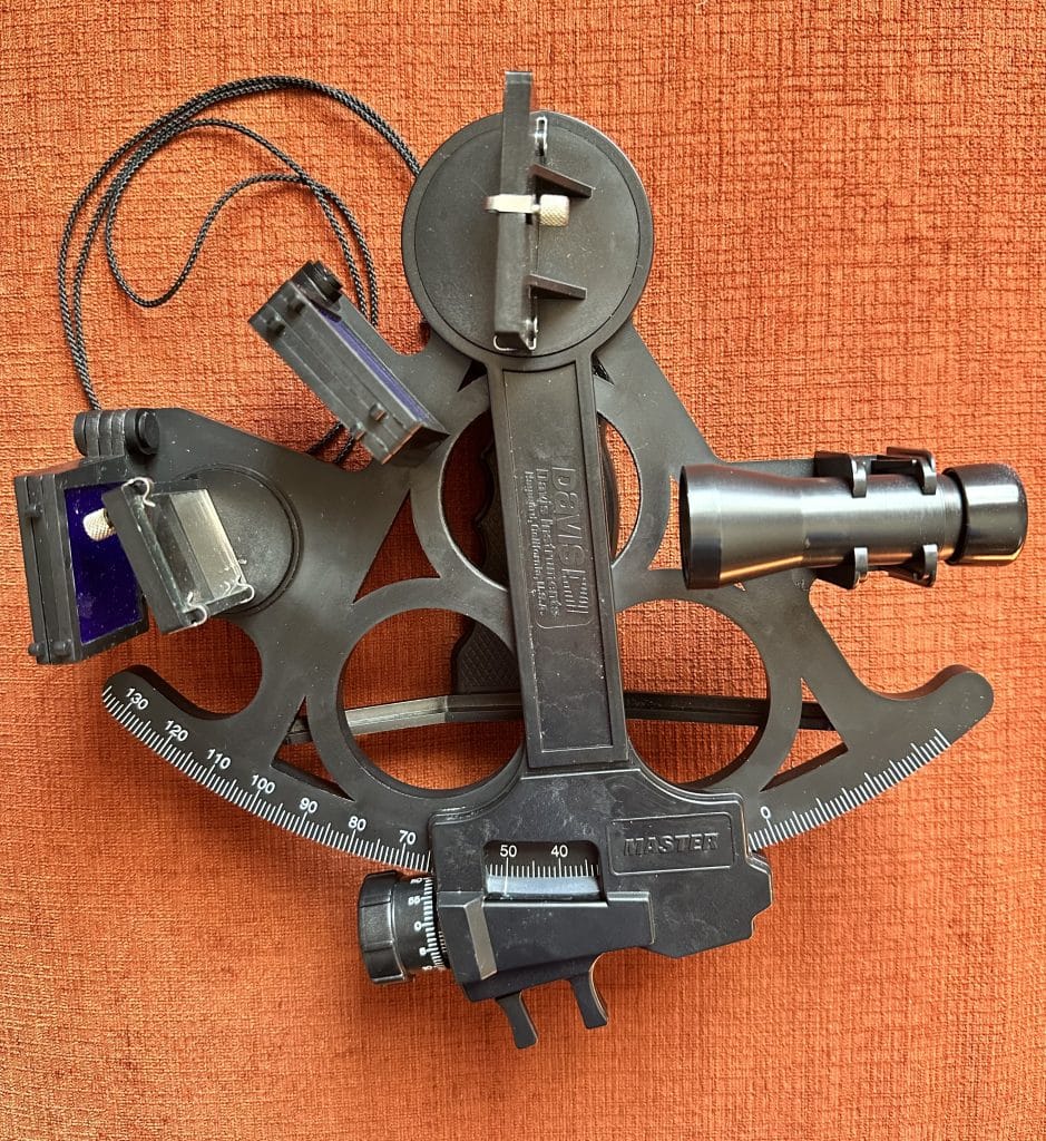
Therefore, using a sextant (to determine when the sun is highest in the sky) and a watch calibrated to Greenwich time it is possible to determine the time that the sun is highest in the sky and then determine your longitude.
For example, here in Boston at 71° west the sun at celestial noon is 4.73 hours after Greenwich. Now you can understand why the east coast time zone is 5 hours after Greenwich Mean Time (GMT). What’s the longitude if local noon is 8 hours after Greenwich noon? Where might you be?
Using Polaris or noon sights of the sun are just two examples of how to determine latitude and longitude. There are other ways one can do this using a combination of stars, planets, the moon or the sun, together with a sextant, calibrated watch and a couple of books containing tables of information about exactly where these celestial bodies are every second of the year. But that’s a long discussion, and maybe requires attendance at Chris’ next class, which I highly recommend.
Ground Zero

Over the new year I visited London with my family and made visits to the British museum and the Royal Observatory at Greenwich. It’s an arbitrary location, but 0° longitude is assigned to Greenwich because this is where a lot of the early celestial research was performed. I even got to stand over the prime meridian – half of me was in the western hemisphere while the other half was in the eastern hemisphere!
Very cool. Just read the story of Flying Cloud, the record setting clipper ship. Obviously they used celestial navigation but the navigator on their record setting journeys was a woman, the wife of the captain. Unheard of at that time!